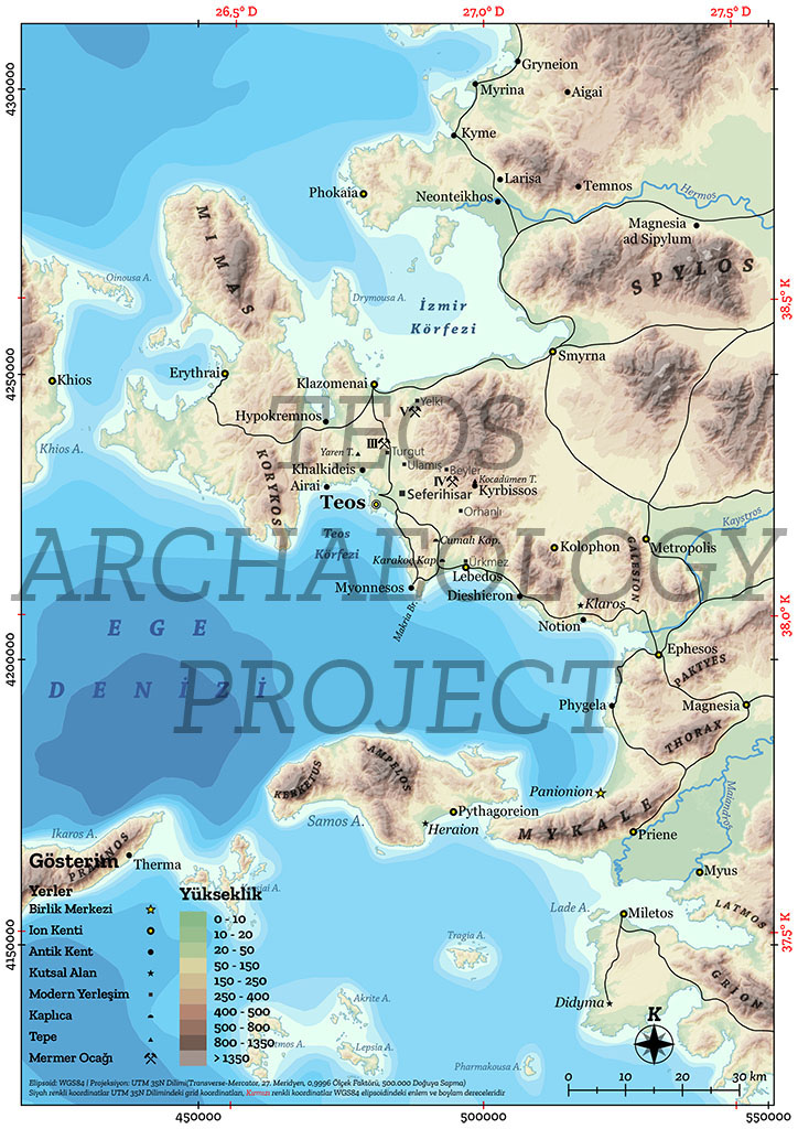
The ancient city of Teos lies within the borders of Turkey’s İzmir province, Seferihisar district, Sığacık neighbourhood, approximately 60 km from İzmir city centre. The city was founded on the southern coast of the Urla-Çeşme Peninsula (ancient Mimas), a small peninsula in the Aegean Sea. Teos’ neighbours were Lebedus (Ürkmez) to the southeast and Clazomenai (Urla Iskele) to the north. According to Strabo, Teos was 120 stadia (~21 km) from Lebedus, between which lied the Island of Apsis, also known as Arkonnesos.
Teos also appears on the Tabula Peutingeriana (The Peutinger Map), a 13th century copy of a 4th century map depicting the road network (viae publicae) of the Roman Empire; on it, it is set between Smyrna and Lebedus, 22 Roman miles (~31 km) from the former and 20 Roman miles (~29.6 km) from the latter. Sığacık Bay is bound to the west by the Korykos Mountains (Kıran and Teke mountains) while Teos Bay is bound to the south by Cape Myonnessus (Çıfıtkale-Doğanbey), extending towards the opposite of the Island of Makris.

Antikçağ’da İonia bölge haritası (Kadıoğlu, 2021, 24, Harita 2)
