Roman cistern, view from North (Kadıoğlu, 2021, 308, Figure 137)
The Roman Cistern is located in the southwestern part of the city, situated at the base of a low hill and constructed in an east-west alignment that conforms to the topography. No evidence has been found indicating the structure served as a fountain; leading to the conclusion that the structure used solely for water storage and possibly supplied water to the Roman Bath located approximately 200 meters to the southeast. Based on the materials, techniques, and craftsmanship, the structure is dated to the Roman Imperial Period (1st and 2nd centuries AD).
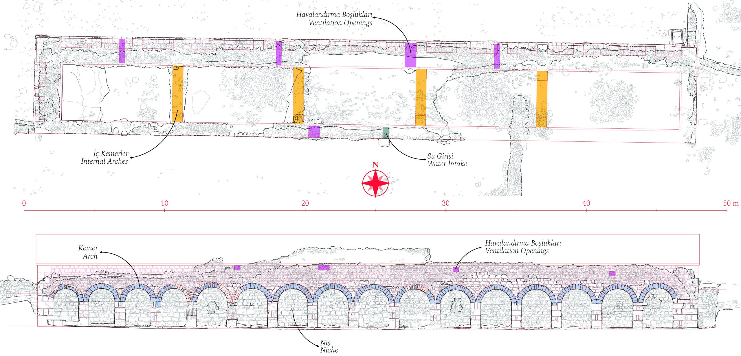
The building has a rectangular plan, 47 m long and 6,80 m wide. There are 16 blind arches on the north façade and 2 blind arches on the west façade. The arches are approximately 2.85 meters high, with spans ranging from 1.70 to 2.20 meters. The east and south walls are completely buried. It is likely that the south wall was supported by the soil fill on its southern side when the structure was constructed. The opening in the middle of the south wall, about 3.50 meters above the ground level of cistern, is thought to have been used for water intake.
The top of the cistern is covered with a barrel vault constructed using rubble masonry and lime mortar. The barrel vault, which is 5.40 meters high from the ground to the top, is supported internally by four arches. These arches, built approximately every 8 meters, not only support the barrel vault from below but also likely helped partition of the water reservoir. The cistern, which has a depth of 3 meters from the ground to the start of the barrel vault, has a minimum water capacity of 542 cubic meters/tonnes. The inner walls up to the start of the vault are plastered with a 10-12 cm thick layer of mortar to ensure watertightness. It is thought that the openings on the north and south sides above the vault level allowed for ventilation, helping to keep the water healthy.

Archaeological map of Teos and its surroundings (Kadıoğlu, 2021, 25, Map 4)

